Maps and Memories at the Festival of Archaeology
Event Description
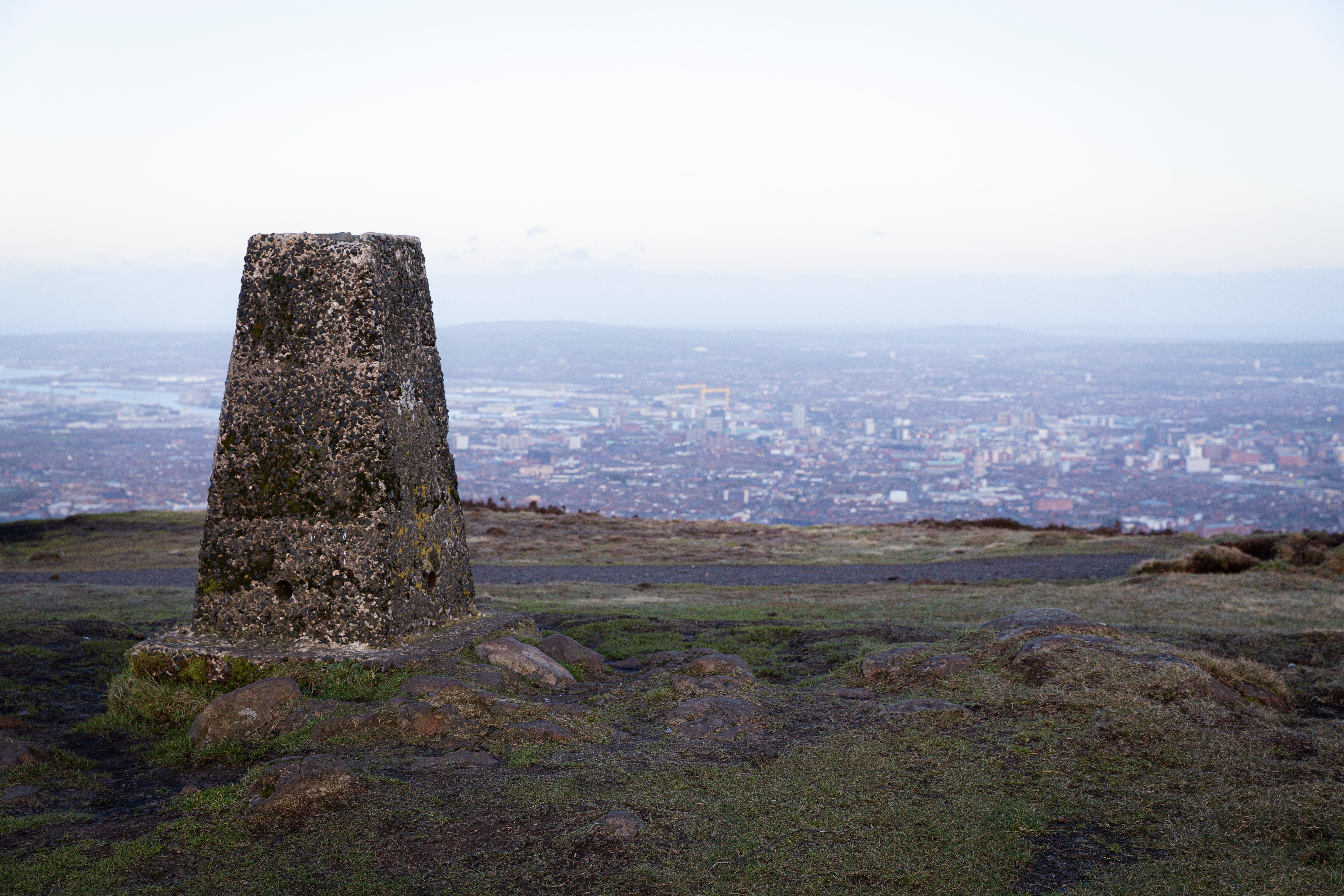
Join us for the first event in our exciting new programme - Maps and Memories. The project will shine a light on the rich and fascinating heritage of the Ordnance Survey in Ireland, marking 200 years since the first mapping survey began on Divis Mountain. Working in partnership with National Trust, Queen’s University Belfast, Ordnance Survey Northern Ireland and the Historic Environment Division, the project will investigate and raise awareness of important trig points (triangulation pillars), which were used to create the first detailed maps of Ireland in the 19th century. These structures are a tangible link to the past and help connect us with the evolution of how we see and record place and space.
Come along and hear from Professor Keith Lilley, Queens University Belfast, about The Archaeology of Map Making at 12pm. Maps are important tools for archaeologists. It’s also true that making maps in the past left behind archaeological traces in the landscape. In this short, illustrated talk, Professor Lilley explores the sites where maps were made and reveals what these tell us about map-making in Ireland in times past. As well as looking at Divis and Black Mountain, and the legacies map-makers left behind here two centuries ago, the talk shows how all of us can join the search for and find the ‘archaeology of map-making’ in our local landscapes. Come along and find out more!
This project has been made possible by the support of National Lottery players.
------------------------------------------------------------------------------------------------------------------------------------------------
This event has been programmed as part of the Festival of Archaeology with the National Trust who are working in collaboration with the Council for British Archaeology. Discover the amazing history of the landscape, from prehistoric times to its important role in founding the Ordnance Survey 200 years ago.
On the mountain, uncover history through a live excavation, take part in guided and sensory walks, enjoy storytelling sessions, and see flint knapping and mapping demonstrations in action.
At Hannahstown Community Centre, families can dive into archaeology-themed fun with kids’ sand trays, dress-up activities, and a heritage explorer challenge. There’ll also be clay art sessions, info from the Historic Environment Record NI, and more.
Key timings on Divis & the Black Mountain:
10.15am: Opening Speech
10.30am & 1.30pm: Guided Walks with National Trust
10.45am, 12.45pm & 2.45pm: Sensory Walks
11am, 1pm & 3pm: Ordnance Survey Mapping Activities
11.15am, 12.30pm, 2pm & 3.15pm: Storytelling
11.30am & 1.45pm: Res Kit Demos
11.45am, 1.15pm & 2.30pm: Céilí Music & Dancing
12 noon - 1pm: 'The Archaeology of Map Making'
Event closes 4pm.
Further activities will be taking place in Hannahstown Community Centre, a free shuttle bus to Divis will be running throughout the day - we encourage all visitors to park at the Hannahstown Community Centre where possible as spaces on Divis will be extremely limited. Please check our social media pages or Divis Café for bus timetable.
Event Partners


You might like these too…
Want to see more?
View all events
