

OS 200 Exhibition
Details
WHERE
Derry-Londonderry
Derry-Londonderry
Type
Exhibitions
WHEN
Wednesday 11th Feb – Sunday 22nd Feb
SUITABILITY
All Ages
Buy
Now Available
Free
Event Description
Explore the research and findings of the OS200’s digital re-mapping of Ireland’s Ordnance Survey Heritage in their pop-up exhibition.
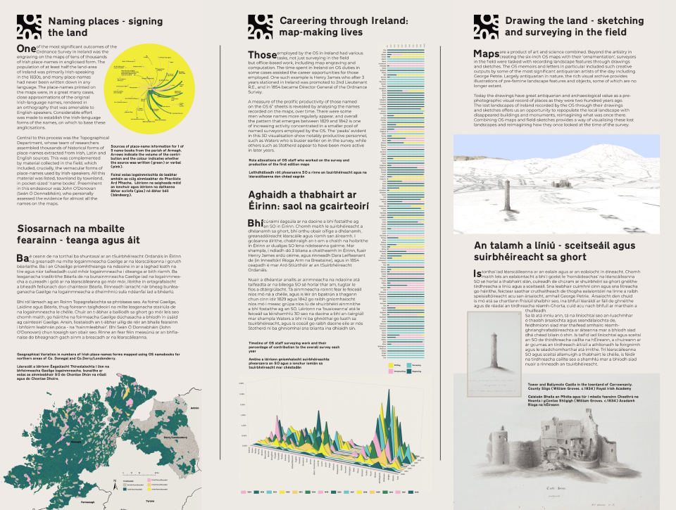
Two centuries ago, Ireland became the first country to be mapped entirely at the scale of six inches to one mile. The map-makers not only recorded features in the landscape, they also left behind a range of local details, including folklore, place-names, antiquities, religion and topography.
Linking together historic OS maps and texts, OS200 connects past and present using 21st-century technologies to analyse and visualise how the OS operated on the ground.
Continue your journey into the history of the Ordnance Survey in Ireland by picking up a ‘Benchmark Trail’ of the city or by reading up about the Lough Foyle’s mapping heritage with the ‘Mapping Monuments’ brochure.
OS 200 is led by Queen’s University Belfast and University of Limerick and made in partnership with: Royal Irish Academy; Public Record Office of Northern Ireland; Digital Repository of Ireland; National Library of Ireland; National Library of Scotland.
With support from Ordnance Survey Northern Ireland (Land and Property Services) and Tailte Éireann (previously Ordnance Survey Ireland).
Event Partners